Postsecondary
Syllabi
Lectures and Videos
Resources

ONLINE RESOURCES
ASOR Map Collections
Map ID: MID000043 – Download Image
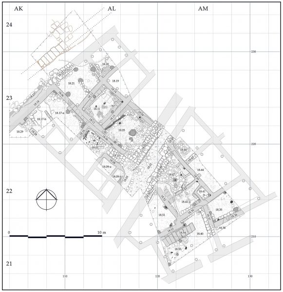
Tell Arqa, Lebanon: Plan of Level 18A
Country: Lebanon
Location: Tell Arqa
Area: Area I-West of the tell
Stratum: 18A
Description: Plan of archaeological structures of Level 18A (EBII)
Category: Architectural Plan, Archaeological Feature
Type: Houses and street dated to the Early Bronze Age II
Period: Early Bronze Age II
Date: 2750 BCE
Credit: Hanan Charaf, Tell Arqa Archives, September 2016
If you would like to contribute to the ASOR Photo Collections or have any questions, please contact Marta Ostovich (programs@asor.org).
