Postsecondary
Syllabi
Lectures and Videos
Resources

ONLINE RESOURCES
ASOR Map Collections
Map ID: MID000017 – Download Image
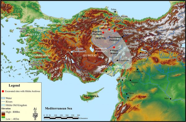
Map: Middle Bronze Age Anatolia
Region: Anatolia
Description: Map of the Hittite old Empire and various Anatolian polities (Wilusa, Arzawa, Lukka, Luwiya, and Kissuwatna) with major sites notes and sites with archives
Category: Maps
Type: Kingdom and Empire Maps, Site Maps, Topographic Maps
Period: Middle Bronze Age
Date: 2000 – 1500 BCE
Credit: Stephen Batiuk, September 2011
If you would like to contribute to the ASOR Photo Collections or have any questions, please contact Marta Ostovich (programs@asor.org).
